Description
Parrot Sequoia
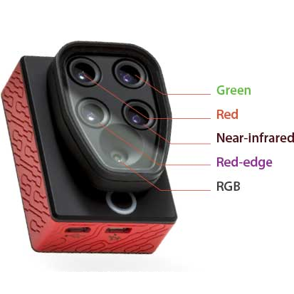
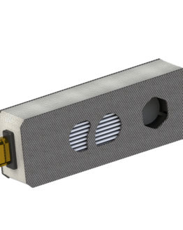
The new sequoia multispectral sensor offers all the advantages of a compact system that integrates 4 spectra and the visible. The integrated GPS allows you to geo-refer images taken in a completely automatic way.
Maximum compatibility
Sequoia can be installed directly on any drone.
Whether it’s a quadcopter, a hexacopter, a fixed wing …. with Sequoia you will not have any problem installing. In a few minutes you will be immediately operational.
The Multispectral Sensor
Capture images in the visible and in the invisible.
With the Parrot Sequoia you can capture images in the various spectra, providing calibrated data to monitor the health and vigor of all the different stages of cultivation and harvesting. Redwood catches the bands green, red, near infrared and red-edge.
The brightness sensor with GPS
Calibra and Georeferenzia photos in a completely automatic.
During the flight phases, the sensor analyzes the lighting conditions and optimizes the shots for maximum image quality. It also stores GPS coordinates to facilitate post-process processing and to identify the area
Connection via USB and Wifi
Download the photos and configure the sensor at any time.
Parrot Sequoia has USB and Wifi connections that allow you to view and download the photos taken and to configure the various room parameters.
Pix4Dmapper Ready
Create orthophotos and generate vegetation indices with just a few clicks.
Pictures taken with Sequoia can be processed using the Pix4Dmapper software. With a few clicks you can generate georeferenced orthophotos and numerous vegetation indices including NDVI and ENDVI.
